|
| Group photo in front of the cultural house of Cu Lac 2 village |
From 9 to 12 April 2012, with the support of GIZ CZM Soc Trang, a group of Soc Trang representatives visited Quang Binh in a study tour to learn more about integrating natural conservation in building participatory economic and social development plan at village, commune and district levels in the buffer zone of Phong Nha-Ke Bang national park. The group had meetings at the GIZ Quang Binh and the Phong Nha-Ke Bang national park offices, listened to their presentations on the project in general and especially on green village development planning (VDP). On April 11, the group also had chances to visit some livelihood models suggested from the VDP and attending a meeting with local people in Cu Lac 2 village, Son Trach commune.
The “Conservation and Sustainable Management of Natural Resources in Phong Nha-Ke Bang National Park Area” is an eight year Vietnamese – German cooperation project. Located 500 km away from Hanoi and 50 km from Dong Hoi city, the Phong Nha-Ke Bang national park has been recognized by UNESCO as World Heritage since 2003. The project site comprised of 3 main areas, (1) the core area of 85,754 ha, (2) the extension area of 31,071 ha and (3) the buffer zone of 225,000 ha, embracing 13 communes (7 communes of Bo Trach district; 5 communes of Minh Hoa district and 1 commune of Quang Ninh district) with 155 villages and a population of 60,000 people.
 |
| Map of the project area |
General goals of the project are integrating sustainable socio-economic development in management and conservation of natural resources and biodiversity of the Phong Nha-Ke Bang national park, reducing pressure on natural resources in the national park area and improving livelihood conditions of local people in the project area. Three key operating areas of the project are (1) protection and management of the national park, (2) development of the buffer zone and (3) sustainable tourism development. In the field of development of the buffer zone, since 2011, two key activities of (1) building conservation-oriented/green village development plans and (2) alternative livelihood models had been conducted with technical support from GIZ Quang Binh.
Green Village Development Planning (VDP)
The buffer zone of the project had faced many challenges. The communities in the buffer zone had high poverty rate with low awareness on natural conservation. Most livelihood activities of local people here were based on exploitation of forest natural resources such as grazing, burn shifting cultivation, reclamation, hunting and trading wildlife, forest wood, minerals. On the other hand, income from tourism had been limited and other alternative livelihoods had not been applied effectively. Though the provincial socio-economic development planning had been implemented, it had not considered yet natural conservation, especially biodiversity conservation and heritage protection in the national park region. The imbalance between economic development and natural conservation in the context of climate change would make the situation worse. Therefore, it is critically essential for the buffer zone to take into account conservation in their socio-economic development planning (conservation-oriented or green development planning).
From January to June 2011, GIZ Quang Binh had supported building 157 green development plans at village level and 13 green development plans at commune level in the buffer zone. One guideline handbook on green development planning at village and commune levels had also been compiled. So far, the green commune development plans of 13 communes in the buffer zone had been approved and these now become important inputs for the 5 year development and investment plan of the buffer zone.
Conservation-oriented socio-economic development planning aims to ensure that village, commune and district development plans (VDP, CDP and DDP) do not exacerbate threats to the biological diversity of Phong Nha-Ke Bang national park’s core and buffer zones; any harmful impacts or encroachment to the core zone are prevented. On the other hand, livelihood activities, identified in the VDPs, CDPs and DDPs, which have potential to reduce threats to the biological diversity of Phong Nha-Ke Bang national park are prioritized for investment. Local socio-economic development, in association with poverty reduction and hunger alleviation is improved in a sustainable way.
Mutual awareness of both local communities (in terms of Phong Nha-Ke Bang national park’s biodiversity values and conservation management issues) and the national park management board (in terms of local people’s livelihood needs and aspirations) is enhanced. Positive relationship between the national park authorities and local communities is strengthened. Solidarity among local communities is also created.
Since it is a process where villagers participate in developing their own village socio-economic development plan, this participatory and bottom-up approach can enhance the implementation of grassroots democracy as well as the effectiveness of investment projects and public services which would be better met with local people’s demands.
The green village development planning is a micro planning process, applying the participatory rural appraisal (PRA) tools and is based on the Decision No. 1309 (2008) of Quang Binh People’s Committee on the participatory socio-economic development planning procedure at commune level in Quang Binh province. Complementary to the Decision No. 1309, the green VDP procedure integrates conservation orientation such as introduction of the national park values, participatory assessment of livelihood impacts, analysis and selecting of livelihoods with conservation-oriented criteria… Main steps of the green VDP procedure applied in Quang Binh are summarized in the following (more details can be read in the guidelines and handbook for Green VDP).
Step 1 – Preparation
This step is very important to provide information, facilities, conditions, guidelines, policies, methods and planning skills as inputs for planners before implementation in the village. Useful information on natural conditions, livelihoods, socio-economy, implemented policies, previous socio-economic development plans, supporting projects… were collected to helps planners image the village situation before developing plan. Necessary stationeries, facilities, documents were also be prepared. High agreement on policies and implementation methods was made with local authorities, departments and unions such as Women Union, Farmers Association. Skills and methods for planning were trained for planners/facilitators. They should have knowledge on ecology, conservation, socio-economy, new agro-forest techniques, sustainable development… in order to support local people in analyzing situation, restoring ecological balance, guiding sustainable development activities, building alternative livelihood models.
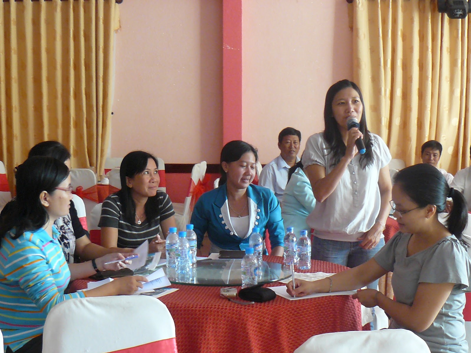
Step 2 – First village meeting
In this step, the need, goals and process of participatory conservation-oriented socio-economic development planning were introduced to villagers. Biodiversity and other values of the national park were also introduced to villagers to raise awareness on conservation. A VDP working group was formed. Villagers chose about 15-20 people (at least 30% should be women) who had experience and capacity to give good contributions in the planning process and who represented for different stakeholders such as local authorities, unions, Women Union, Youth Union, ethnic groups…
Step 3 – Planning meetings
In this step, participatory rural appraisal (PRA) tools were used for participatory impact assessments. Current livelihood activities were listed. Those activities threatening conservation were analyzed to be ranked by the levels of impacts and finding solutions for mitigation. Current land use was analyzed through people drawing their own village’s current land use map and ecological cross-section. Through current land use map, the boundary of the national park was identified for people not to encroach. Then, potentials and solutions of alternative livelihood models, vocational training, public services were analyzed, ranked and selected with conservation-oriented criteria. Priority for forestry activities, non-timber forest, industrial crop, cash crop and livestock were identified. Future conservation-oriented land use plan was drafted.

Flipchart listing of livelihood activities having impacts to conservation and suggested solutions
Two guiding posters on livelihood activities with positive (left) and negative (right) impacts to biodiversity of the Phong Nha-Ke Bang national park on the wall of the Cu Lac 2 village’s cultural house.
Flipchart describing current ecosystem in Cu Lac 2 village with cross-section through forest, plantation, lakes, garden, rice areas; their current situation, difficulties and suggested solutions.
Matrix of forest and non-timber trees with conservation-oriented criteria for assessment and identifying priority (Cu Lac 2 village)
Ranking of livelihood, vocational training activities need for supporting (Cu Lac 2 village)
Step 4 – Drafting of the village’s 5 year action plan
At this step, results of the planning meetings were synthesized to help villagers and local authorities to see what activities would be conducted, when, how and who would be responsible. Draft of village development plan for 5 year in general and one year in detail was built. This action plan served as the basis for the project to make more practical and people’s aspiration – based activities to support villagers and the community.

The draft five year action plan for Cu Lac 2 village
Step 5 – Final village meeting
The final village meeting aimed to create high agreement through discussion and supplementing the draft version of action plan and future land use that the VDP working group had built. Therefore the more villagers attended the meeting the better. The head of the village presented the draft plan and letting people to contribute their ideas. After the meeting, the conservation-oriented village development plan was completed.
Step 6 – Building participatory commune socio-economic development planning (CDP)
In this step, the conservation-oriented village socio-economic development plans of villages in the commune were synthesized into the commune socio-economic development plan. This commune development plan was then presented to commune local authorities for consultation. A meeting for the commune development plan’s approval was held.
Step 7 – Integrating CDPs into the district socio-economic planning
At this step, the approved commune socio-economic development plans of communes in the district were submitted to the District People’s Committee. They would then be integrated into the socio-economic development planning of the whole district.
Step 8 – Periodically evaluation meetings
Meetings for evaluation of the conservation-oriented socio-economic development planning’s implementation results should be held periodically (6-monthly, yearly).
The project acknowledged some challenges and limitations during deployment of the green VDP process. To conduct participatory planning for 157 villages in the 13 communes, it required quite a big amount of time and work. The participation of ethnic minority women was still limited. Skills training for participating officers as well as raising awareness for stakeholders was also an issue. In addition, some villages were in remote areas which made them not very easy to access. On the other hand, previous and other on-going projects in the area could have impacts to the project as some projects came with many expectations from local people and when these projects ended, people were left with some faith lost. Moreover, it was always a challenge between the project’s limited budget and the development demand of the villages.
After completing the village development planning, since October 2011, based on people’s wishes and the priority set, 6 alternative livelihood models of safe vegetables, chicken, VA06 weed, bamboo shoot, improved stove and sweet potato have been developed for 77 chosen households in 5 communes of Bo Trach district. Aim of the activity was job and income generation for local people, hence reducing pressure of natural resource exploitation. These livelihood models received both initial capital by KfW and technical support by GIZ. Local people were also required to contribute some reciprocal capital to ensure their responsibility and commitment.
On Wednesday April 11, we were divided into 2 groups, each group visited 6 livelihood models in different sites. Group 1 (Mr. Tran Van Ho, Mr. Nguyen Ngoc Vinh, Mr. Pham Huu Lai, Mr. Phan Van Xe, Mrs. Trieu Thy Thanh Thao, Mr. Nguyen Van Ngo, Mr. Pham Van Vung and Ms. Pham Thuy Duong) went to Phu Dinh and Hung Trach communes. Group 2 (Mr. Tran Van Thanh, Mr. Nguyen Van Thu, Mrs. Lam Thi Thanh Diem, Mr. Ngo Dang Son, Mr. Tran Thanh Long, Mr. Le Hoang Nhin, Mrs. Nguyen Thi Phuong and Mr. Ho Thanh Kiet) went to Son Trach, Phuc Trach and Xuan Trach communes.

Safe vegetables model in village 6, Phu Dinh commune
Chicken for meat model in village 6, Phu Dinh commune
VA06 weed model in Khuong Ha 3 village, Hung Trach commune

Bamboo shoot model in Khuong Ha 3 village, Hung Trach commune

Improved stove model at Mr. Nghien’s house, Khuong Ha 4 village, Hung Trach commune

Sweet potato model at Mr. Son’s house, Khuong Ha 5 village, Hung Trach commune
Because they were first pilot models, the lessons learned and experiences can be taken into account for future planning and selection of alternative livelihood models. For example, the improved stove model would not be recommended as it turned out to be quite complicated in operation. Moreover, alternative livelihood models should link to sustainable tourism development to provide more jobs and income for local people as well as to preserve the natural resources.
Although conservation activities take time to show their effectiveness, to some extent, this participatory, grass root approach had brought out many benefits to all stakeholders. Local communities’ awareness on biodiversity and natural heritage values of the national park and other conservational issues was enhanced. In addition, through participation in the planning process, people’s roles were empowered; their aspirations were heard and better met.
For the national park, the planning process was a good chance to widely disseminate its conservation message and to consolidate its cooperation relationship with local communities. For local authorities, their socio-economic development planning methodology was improved in a more sustainable way.
In general, the conservation-oriented socio-economic development planning in Quang Binh could and should be replicated in other places, particularly where there are conservation issues. In the case of Soc Trang, though natural conditions of the province are different compared to Quang Binh (delta rice field compared to karst and mountains), the mangrove forests along the coastline of Soc Trang are valuable resources that should be conserved and developed. On the other hand, since our project in Soc Trang has already some pilot activities on mangrove co-management, this can be an advantage to integrate the conservation-oriented socio-economic development planning into the co-management processes. If that is the case, more in-depth training on PRA tools and other implementing skills should be organized.